


SCIPIO, Allen County, Indiana
About
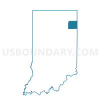
Outline

Summary
| Unique Area Identifier | 576306 |
| Name | SCIPIO |
| County | Allen County |
| State | Indiana |
| Area (square miles) | 13.22 |
| Land Area (square miles) | 13.22 |
| Water Area (square miles) | 0.00 |
| % of Land Area | 100.00 |
| % of Water Area | 0.00 |
| Latitude of the Internal Point | 41.22794900 |
| Longtitude of the Internal Point | -84.82493360 |
Maps


Graphs
Select a template below for downloading or customizing gragh for SCIPIO, Allen County, Indiana


Neighbors
Neighoring Voting District (by Name) Neighboring Voting District on the Map
- Voting District CARRYALL TWP, Paulding County, OH
- Hicksville Township, Defiance County, OH
- MAUMEE, Allen County, IN
- NEWVILLE, DeKalb County, IN
- SPENCER, DeKalb County, IN
- SPRINGFIELD A, Allen County, IN
Top 10 Neighboring County Subdivision (by Population) Neighboring County Subdivision on the Map
- Hicksville township, Defiance County, OH (4,979)
- Springfield township, Allen County, IN (4,349)
- Carryall township, Paulding County, OH (2,980)
- Maumee township, Allen County, IN (2,620)
- Spencer township, DeKalb County, IN (1,233)
- Newville township, DeKalb County, IN (558)
- Scipio township, Allen County, IN (414)
Top 10 Neighboring Unified School District (by Population) Neighboring Unified School District on the Map
- East Allen County Schools, IN (65,612)
- DeKalb County Eastern Community School District, IN (7,841)
- Hicksville Exempted Village School District, OH (5,350)
- Antwerp Local School District, OH (3,857)
Top 10 Neighboring State Legislative District Lower Chamber (by Population) Neighboring State Legislative District Lower Chamber on the Map
- State House District 74, OH (118,430)
- State House District 75, OH (112,019)
- State House District 85, IN (78,990)
- State House District 79, IN (62,178)
Top 10 Neighboring State Legislative District Upper Chamber (by Population) Neighboring State Legislative District Upper Chamber on the Map
Top 10 Neighboring 111th Congressional District (by Population) Neighboring 111th Congressional District on the Map
Top 10 Neighboring Census Tract (by Population) Neighboring Census Tract on the Map
- Census Tract 109, Allen County, IN (6,369)
- Census Tract 101, Allen County, IN (4,763)
- Census Tract 9583, Defiance County, OH (4,381)
- Census Tract 9602, Paulding County, OH (4,339)
- Census Tract 208, DeKalb County, IN (4,280)